
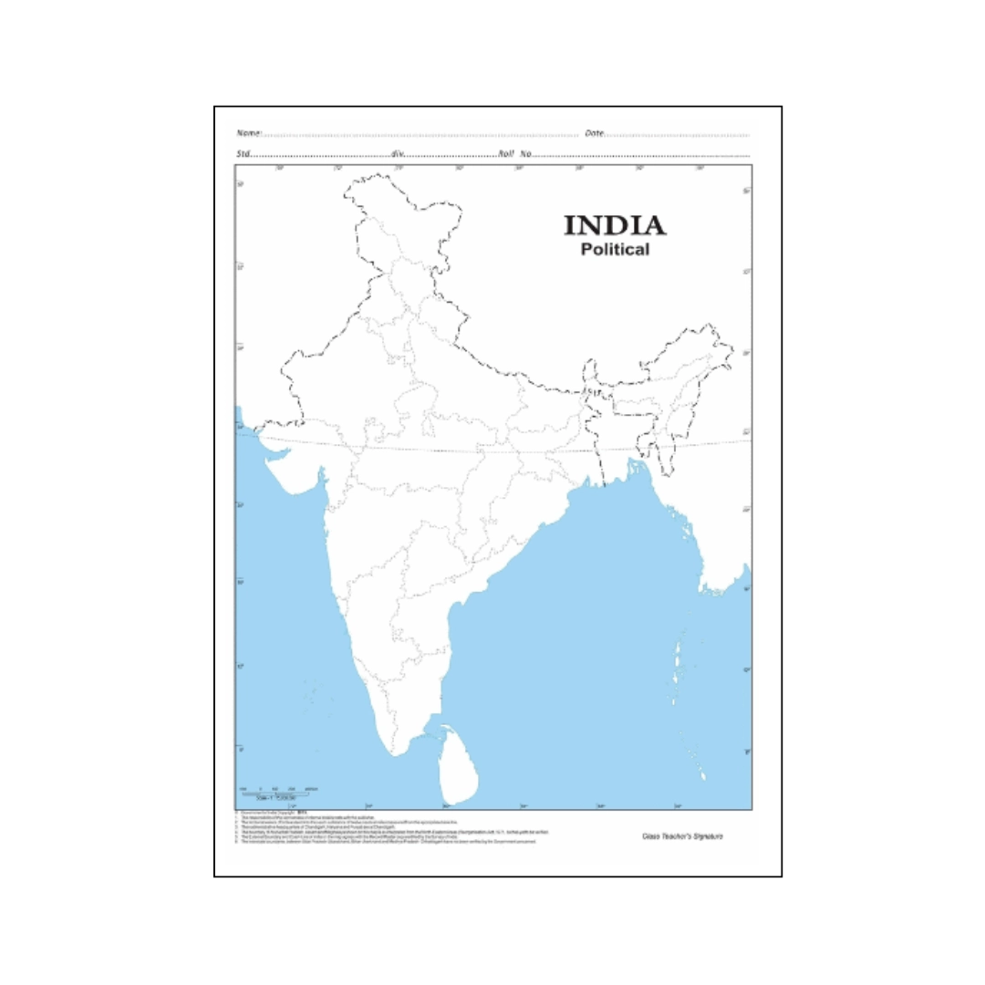
Build a solid foundation in Indian geography with this high-clarity India Political Map. Carefully engineered to meet curriculum standards across CBSE, ICSE, and State Boards, this map provides a clear, reliable reference for school students as well as UPSC, State PSC, SSC, and NDA aspirants.
Each state and union territory is distinguished with contrasting, eye-friendly colours and sharp boundary lines, making administrative divisions, capital cities, and strategic borders effortless to locate and memorize.
Key Features:
-
Current Administrative Boundaries: Reflects the latest internal boundaries across all 28 States and 8 Union Territories with their respective capitals and major administrative hubs.
-
Student-Centric Visual Clarity: High-contrast colour shading between adjoining states prevents confusion and enhances visual recall for map-pointing questions and exams.
-
Geographical & Maritime References: Highlights the Tropic of Cancer, Standard Meridian of India (82°30′ E), neighboring sovereign nations, the Arabian Sea, Bay of Bengal, Indian Ocean, and island territories (Lakshadweep and Andaman & Nicobar).
-
Sharp, High-Resolution Typography: Crisp, readable fonts ensure that even compact states, northeastern regions, and island groups are easy to identify without eye strain.
-
Durable Paper Quality: Printed on thick, premium paper designed to resist frequent handling, pin-ups on soft boards, or desk-top reference during revision.
-
Multi-Purpose Use: Ideal for school geography projects, wall mounting in study spaces, coaching institute classrooms, and daily current affairs tracking.
Specifications:
-
Product: India Political Map
-
Target Audience: School Students (Classes 6–12), UPSC/State PSC/SSC Aspirants, Educators
-
Map Type: Political / Administrative
-
Language: English
-
Orientation: Portrait
-
Finish: Matte non-glare print for comfortable reading under desk lamps
-
Best Used For: Study room walls, soft boards, classroom display, and map-marking practice
Reviews
There are no reviews yet.